

A short note to let you know what’s happening with the Personal Landscapes podcast this summer.
Most of the podcasts I listen to tend to take a short break in summer. I don’t. My ‘short breaks’ happen when I’m traveling.
There will only be one episode in July, rather than the usual two, and probably no episodes in August.
I prepared for several more but unfortunately I wasn’t able to pin down the writers for a recording session. Schedules change, potential guests go silent. It happens.
If all goes well, I’ll be back home in mid to late August, and back to recording podcast conversations by September.
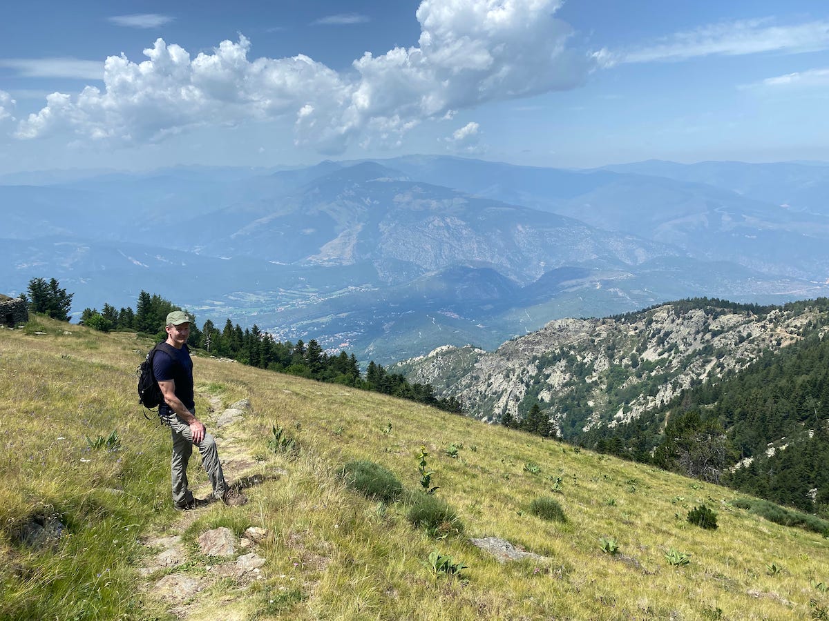
I'm walking the length of the Pyrenees, from Atlantic to Mediterranean, staying high up near the main ridge the entire time.
It's a sort of farewell-to-Europe walk after 15 years living on the continent, six of them in Malta and the rest in Berlin.
I hope to finish by mid-August, but who knows? It's a huge amount of elevation gain and decline each day.
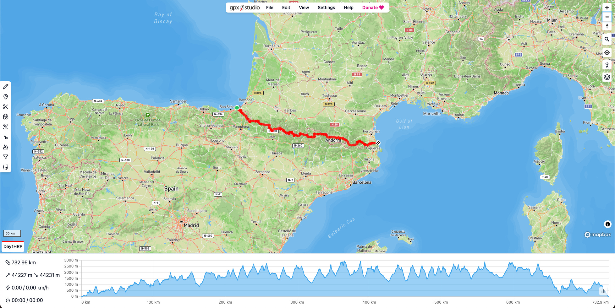
If you’re a hiker, you’ll know that I’m following the Pyrenean Haute Route, or Haute Randonnée Pyrénéenne (HRP).
It isn’t a fixed hiking trail, like the two that run the length of the Pyrenees, lower down, on the French (GR 10) and Spanish (GR 11) sides of the border.
The HRP is a looser ‘route’ that straddles the border, using a mix of existing trails (like the GR 10 and GR 11), local trails, and cross-country navigation in order to stay as close as possible to the main ridge of the Pyrenees the entire time.
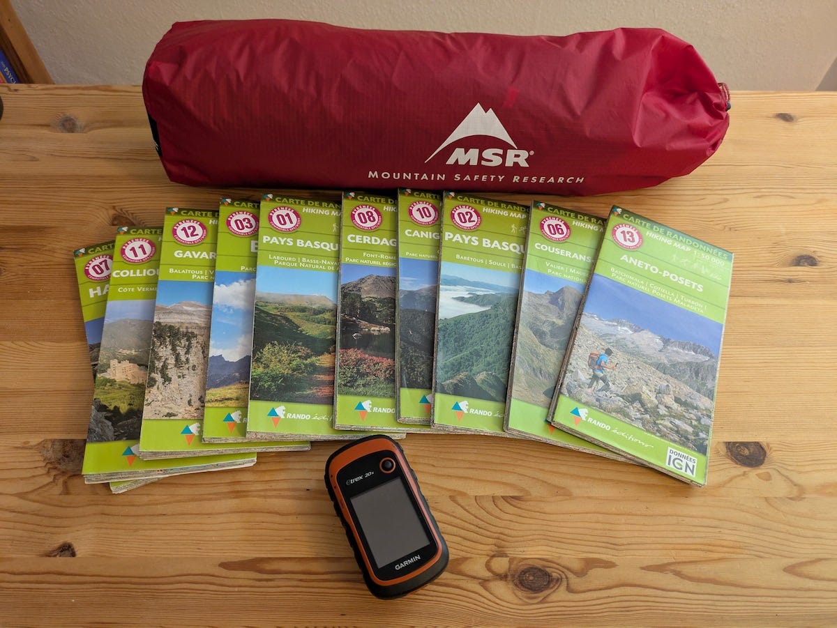
The stack of maps that cover the route weighs more than my tent.
I’ll try to post the occasional update when I resupply in a village. You’ll find them here on Substack, instead of on my author website. It’s easier to update Substack using my phone (I think…).
I’ve also scheduled a few new book reviews and videos to publish automatically for your enjoyment.
We will reconvene for more conversations on books about place in September. Until then, I hope you have a wonderful summer.
Sounds like a plan🥾
Have a great hike! Maps are great but you could try using a mapping system through your phone. Some run off satellites and hardly drain a phone otherwise set on airplane mode thetrail-head.org